|
|
 |
|
|
|
|
|
|
|
|
|
|
|
|
|
|
|
|
|
|
|
|
|
|
|
|
|
|
| ||||||||||||
|
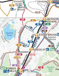
Existing Bus Routes MBTA map showing bus and subway routes in Jamaica Plain. The new rail service will follow (and replace) existing #39 bus service, extending the E branch of the Green Line (presently terminating at Heath St). |
||||||||||||

|
MBTA map of pre-1986 Arborway Line
This is a section of the MBTA's Green Line map, posted at Park Street station. The light section (beyond Heath Street) is the "temporarily suspended" service on the E-Arborway branch of the Green Line. |
||||||||||||
|
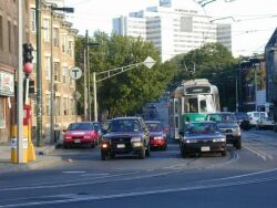
Riverway Station.
Green Line train at Riverway station (E line, on South Huntington Ave).
This section is the only existing street-running segment of the Green
Line. The Arborway line will also operate in mixed traffic, but will
have better station facilities.
| ||||||||||||
|
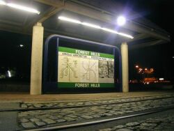
Forest Hills Station.
This platform at Forest Hills station will probably become the southern
terminus of the MBTA's "E" branch on the Green Line. The station is a
major intermodal center, providing connections to the Orange Line, the
Needham commuter rail, and numerous bus lines.
|
||||||||||||
|
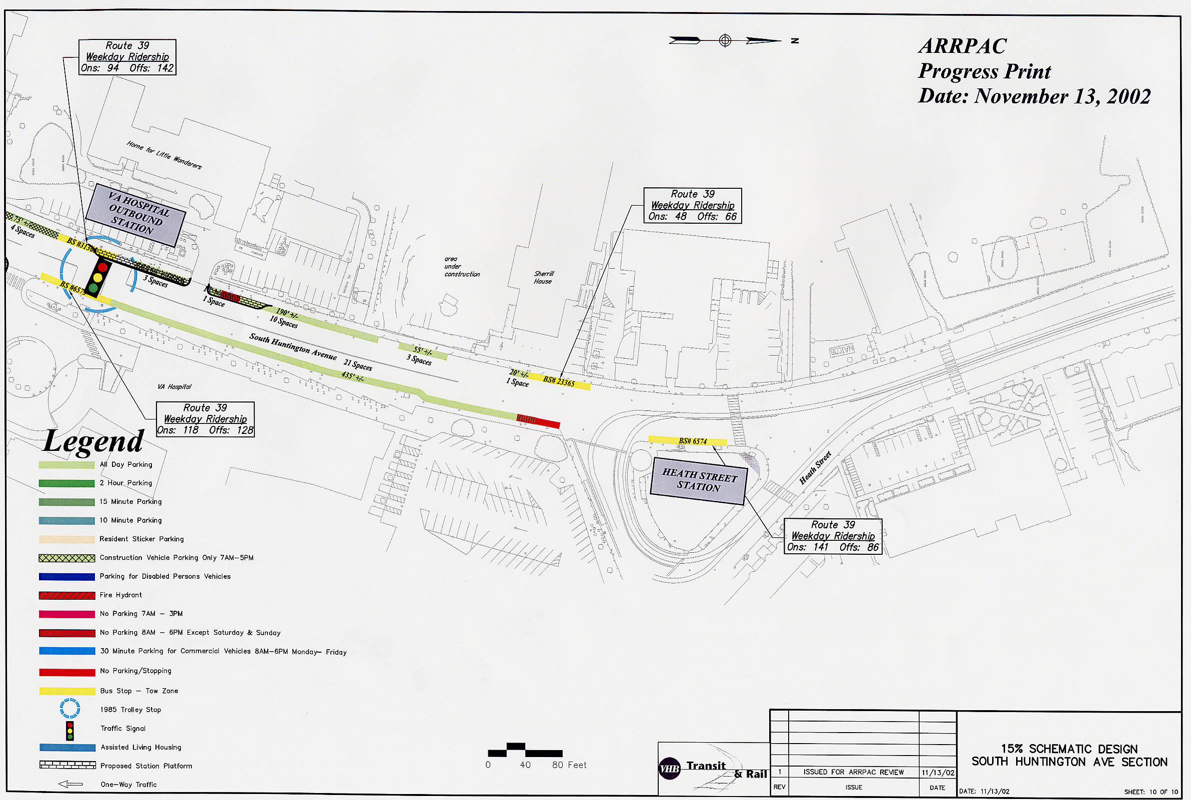
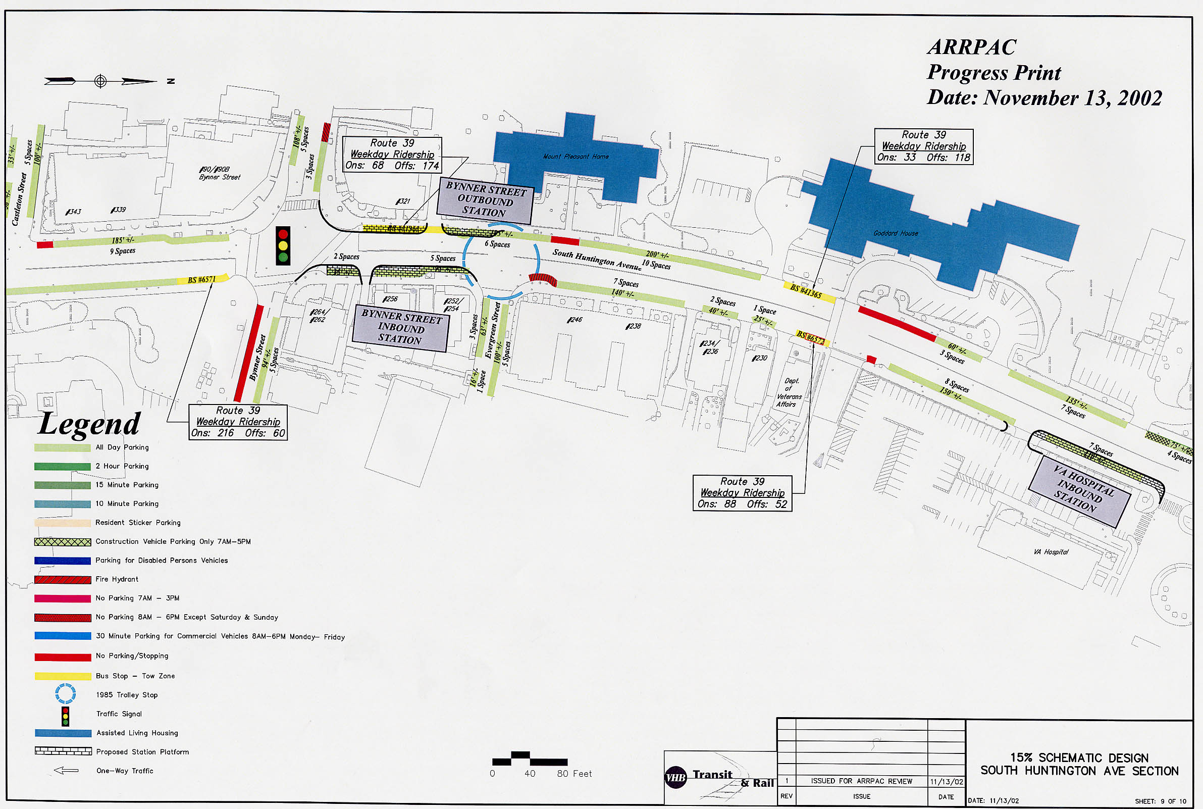
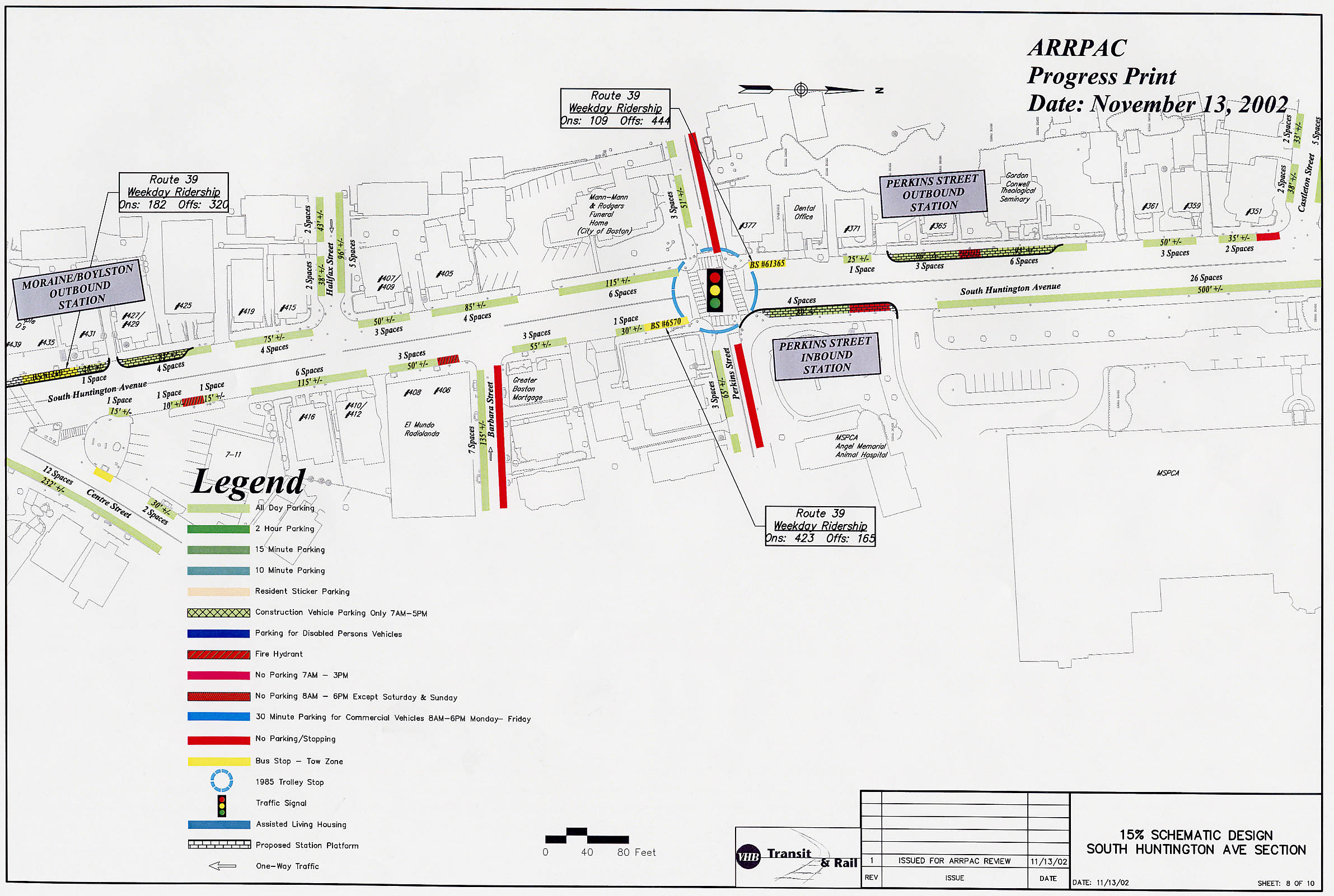
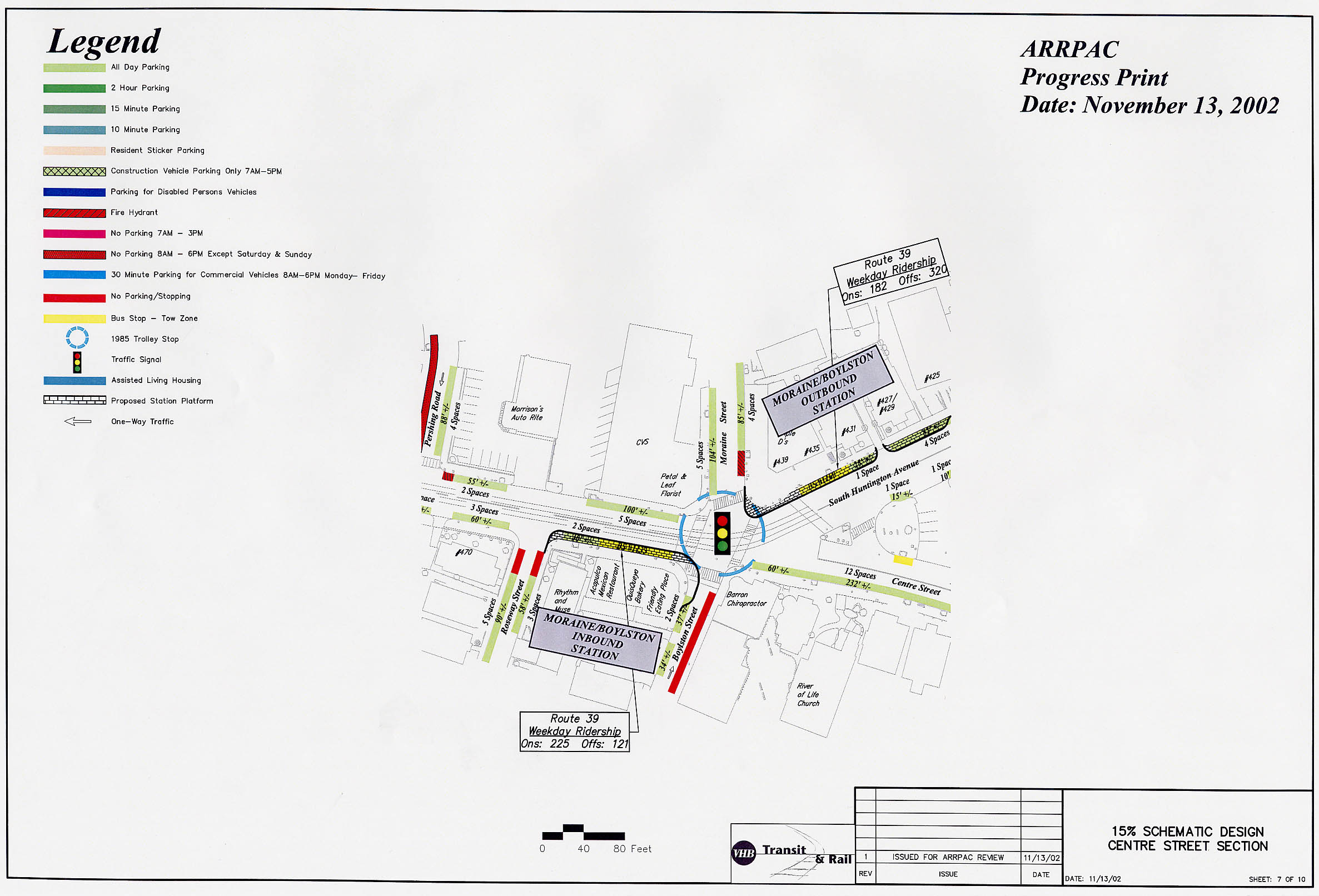
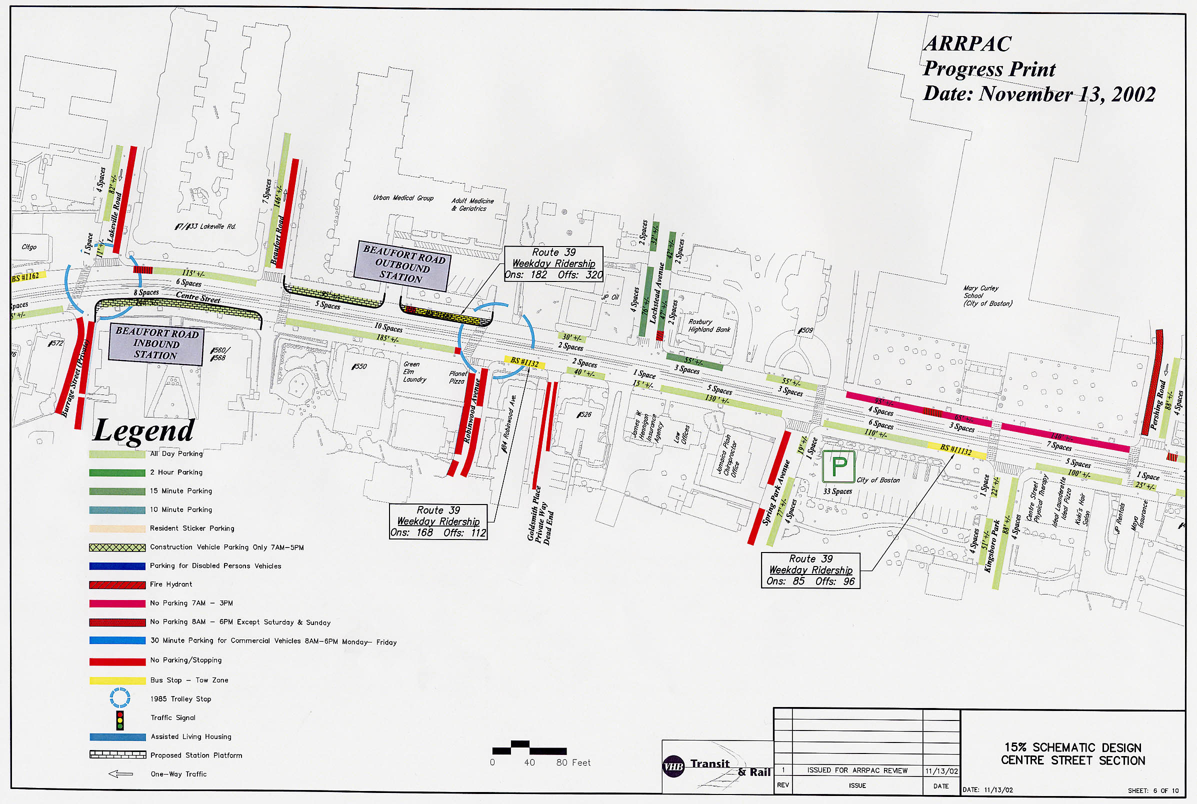
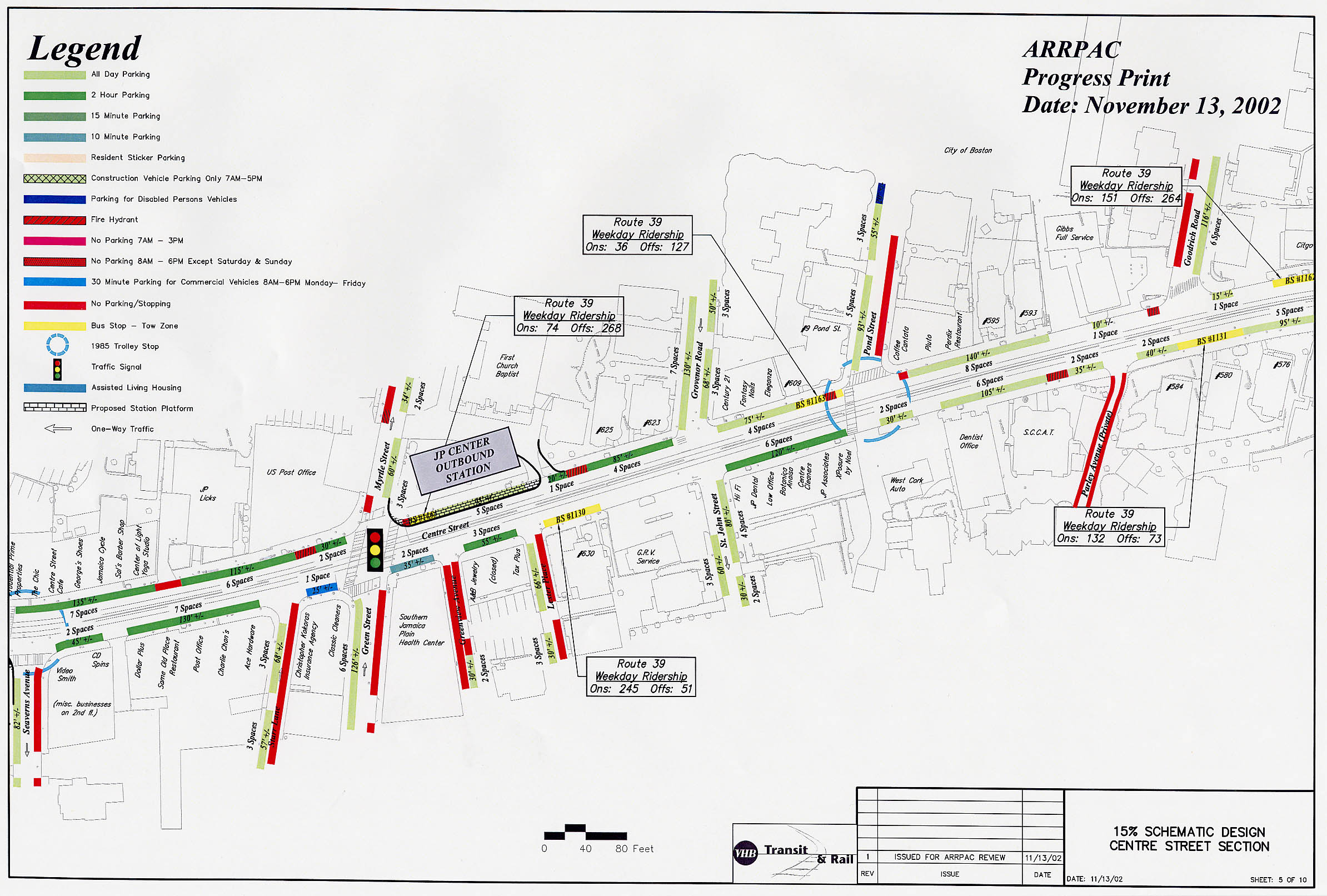
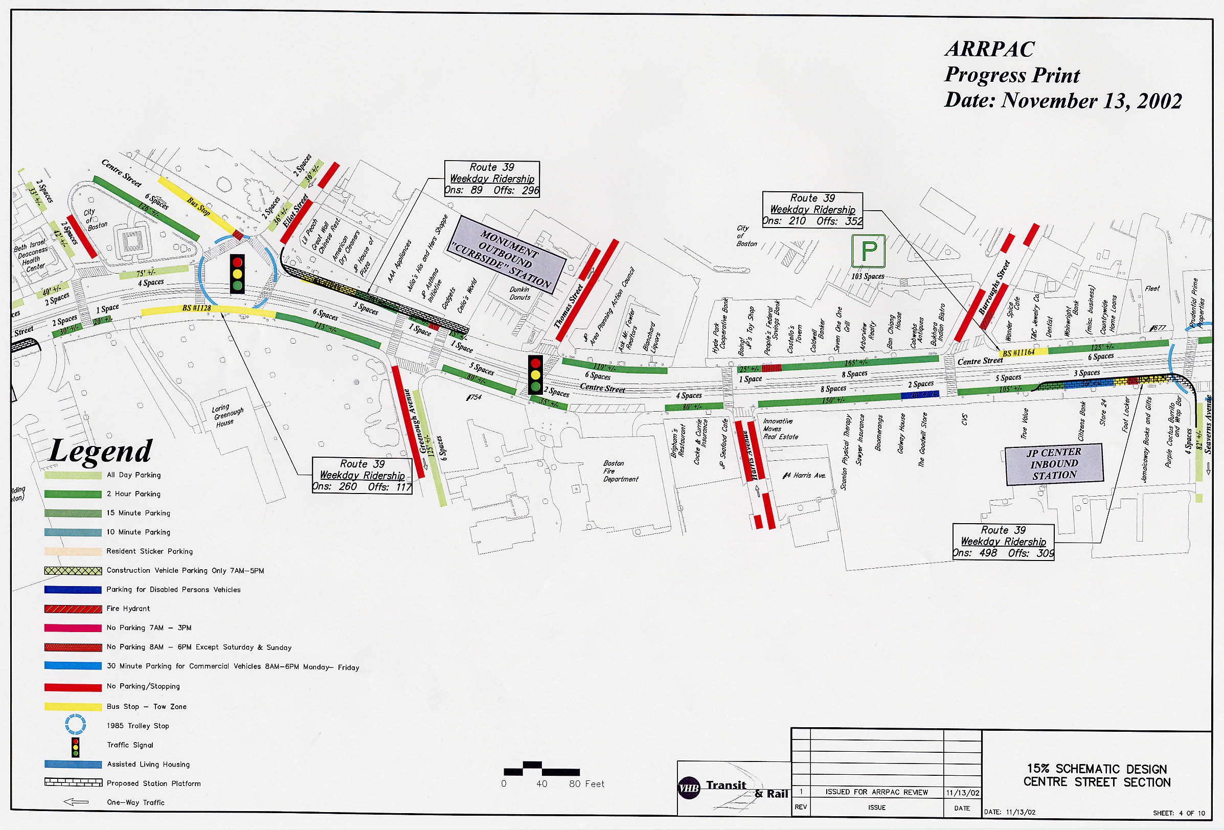
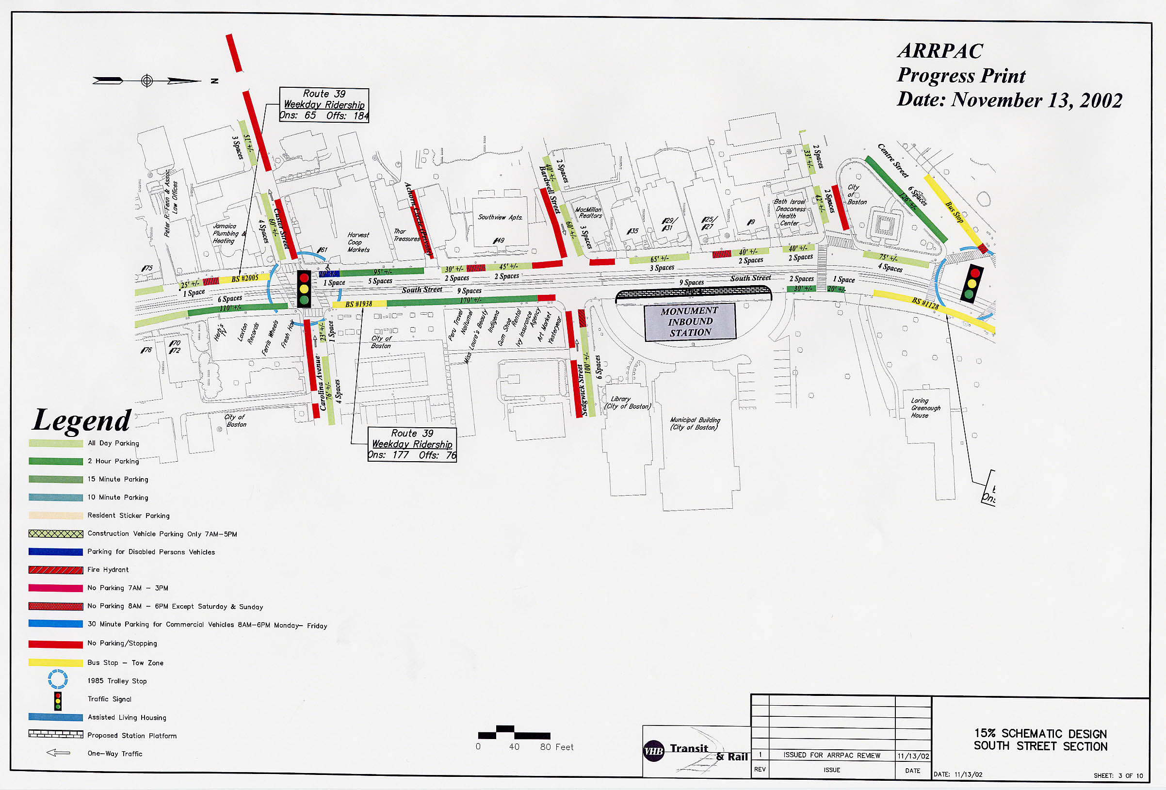
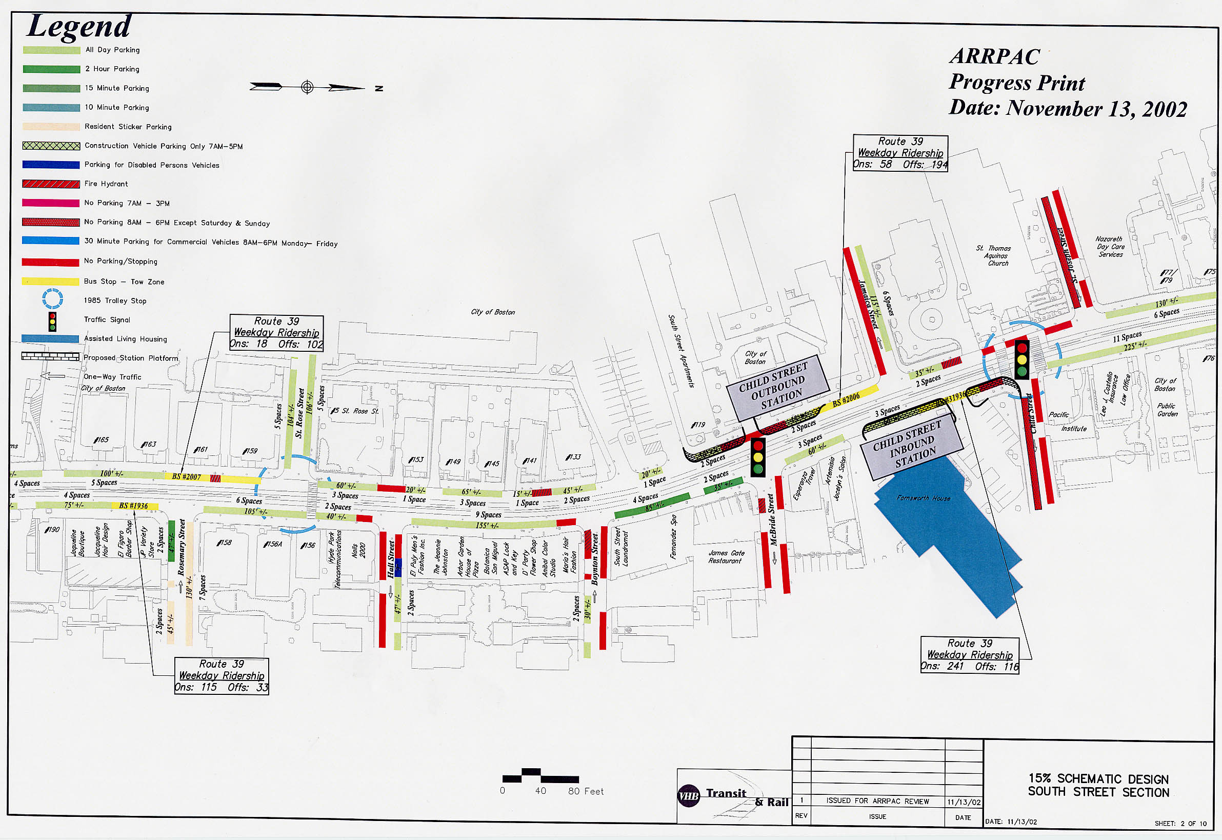
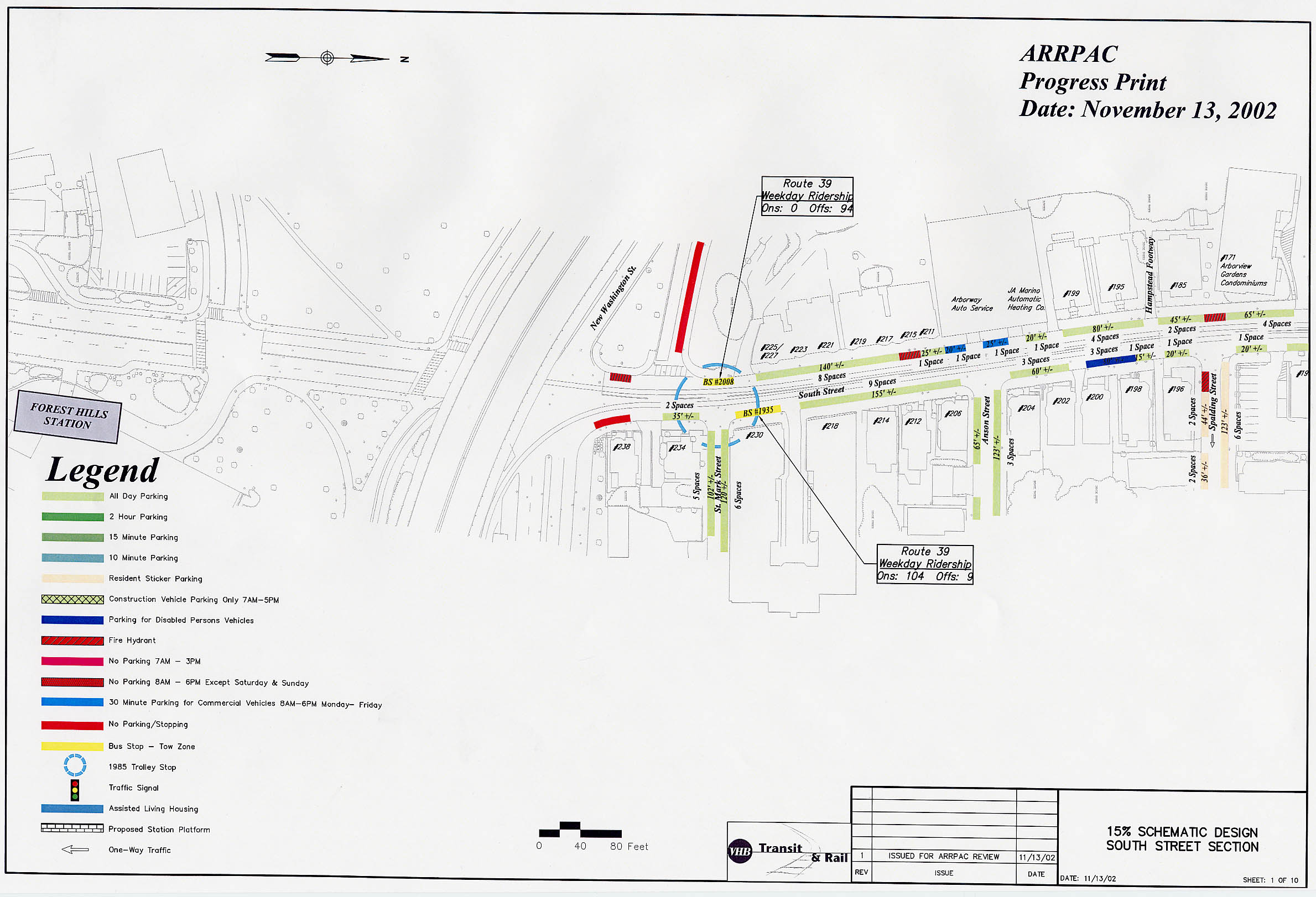
Existing Conditions
The MBTA has provided a set of detailed charts showing existing conditions along the Arborway corridor. These illustrations show the exact configuration of the streets, including intersections, crosswalks, parking spaces, bus stops, fire hydrants, etc. Possible site locations for the proposed stations are also indicated. These are available as a series of 10 high-resolution images, each covering a portion of the corridor:
| |||||||||||||