|
|
 |
|
|
|
|
|
|
|
|
|
|
|
|
|
|
|
|
|
|
|
|
|
|
|
|
|
Green Line train in mixed traffic at Riverway Station. The new service will include station platforms for better safety and accessibility. Photo by Sean Sullivan. |
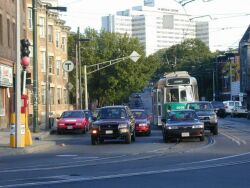
Street Operations The Arborway line runs along existing streets in Jamaica Plain. The streetcars will operate in mixed traffic, using the same lane as the cars. There is not sufficient room for creating a dedicated travel path on these streets. The line will extend from the current Green Line terminus at South Huntington & Heath St, running along South Huntington to the five-way intersection with Centre, Moraine and Boylston. The line will then follow Centre St through the central business district to Monument Square, and turn onto South St, ending at Forest Hills station (Orange Line). Over this region, there is one traffic lane in each direction, and one curbside lane dedicated to parking and MBTA bus stops. The traffic lane will serve both cars and Green Line trains, in a manner similar to the present situation between Brigham Circle and Heath Street (see photo on left). The curbside lane will still be used primarily for parking. At Green Line stations, passenger platforms will be constructed in the curbside lane. Streetcars will stop in the traffic lane to let passengers board and exit the train. It is expected that bus stops will be removed from the corridor, and bus lines still serving Jamaica Plain (#31, #41, #48) will stop at the Green Line platforms. Note that #39, the frequent bus in this region, will cease operations when the Green Line resumes service to its route. |
|||||||||||||||||||||||||||||||||||||||||||||||||||||||||||||||||||||||||||||||||||||
Construction of raised platform at Washington Square station (C Line). Photo by Sean Sullivan. |
Station Design The stations on the Arborway line will typically be built in the curbside lane, creating a waiting space that provides safe access to trains and does not obstruct the sidewalk. To support the use of two-car trains, and the use of all doors from these trains, platforms will extend over a length of 130 feet. In accordance with federal regulations (ADA), all stations on the Arborway line will be accessible to persons with disabilities. The new "Type 8" Green Line vehicles, designed for accessibility, require station platforms that are raised 8 inches above the rails (street level). With slightly raised platforms constructed in the parking lane, the stations will be clearly demarcated relative to their surroundings. ARRPAC has not yet discussed any details of station design, but it is probable that the platforms will be equipped with benches, MBTA and neighborhood maps, lighting, trash cans, and rain shelters. There is also an opportunity for artistic elements that give each station a distinctive flavor. In some areas of the Arborway line, there are no 130-foot sections of unbroken curbside available for use as a station platform. Therefore, it may sometimes be necessary to build the platform in two segments, leaving space for an existing driveway. Since trains will stop at a defined place relative to the platform, these platform gaps will not interfere with safe Green Line operations. |
|||||||||||||||||||||||||||||||||||||||||||||||||||||||||||||||||||||||||||||||||||||

Type 8 Green Line streetcar, on B line at Washington Street. These new vehicles, more accessible for persons with disabilities, will be used on the Arborway line. Photo by Sean Sullivan. |
Green Line Trains The MBTA intends to operate one-car and two-car trains on the Arborway line, depending on the time of day. To support ADA requirements for accessibility, at least one car in every train will be a "Type 8" -- one of the 100 new Green Line vehicles ordered from Breda. When running in two-car trains, the other car may be either another Type 8, or one of the "Type 7" vehicles in the current Green Line fleet. The frequency of Green Line service has not yet been discussed. We anticipate that service levels will be similar to existing service on the Green Line: about every 10 minutes on nights and weekends, and more frequent during rush hour. In very preliminary discussions with the MBTA, it appears that the E line trains may run between Forest Hills and Lechmere. However, no decisions have yet been made about operations on this line. Therefore, it is possible that the new E line may terminate downtown at Park St, Government Center or North Station. As a historical note, pre-1986 Arborway service only ran to Park Street station. In any case, it is evident that the Arborway line will provide one-stop rides between Jamaica Plain and downtown Boston. |
|||||||||||||||||||||||||||||||||||||||||||||||||||||||||||||||||||||||||||||||||||||
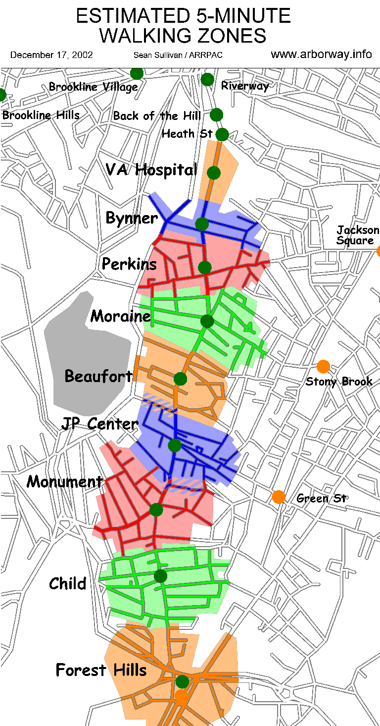
5-minute walking zones around proposed stations (approximate). Click on map for full-size image. |
Station Locations In November 2002, ARRPAC completed a draft design recommendation regarding station locations on the Arborway line. These recommendations are provisional, pending community feedback and engineering design assessments. Major factors influencing the proposal included:
The station locations in this draft recommendation:
|
|||||||||||||||||||||||||||||||||||||||||||||||||||||||||||||||||||||||||||||||||||||
|
Bus Route #39 Ridership
For each stop on the #39 bus (being replaced by the Green Line), this table shows the daily ridership according to MBTA statistics. The relative intensity of demand for public transit along the Arborway corridor can be seen by reviewing these statistics. Each value combines total daily passengers on & off the bus at a given stop. Except as noted, each stop represents the added values for an inbound stop and outbound stop. Total ridership is 9,722. The five stops with ridership above 650 are marked in bold, and account for slightly over 50% of the total ridership.
Statistics were not available for #39 ridership at Forest Hills station. We can use these values to estimate the relative intensity of demand at the new Green Line stations. The actual ridership is expected to vary because of the change in service, but this can give a rough sense of proportion:
... with the ridership at St Mark (Bus stop #17) rolling over to Forest Hills.
|
||||||||||||||||||||||||||||||||||||||||||||||||||||||||||||||||||||||||||||||||||||||
|
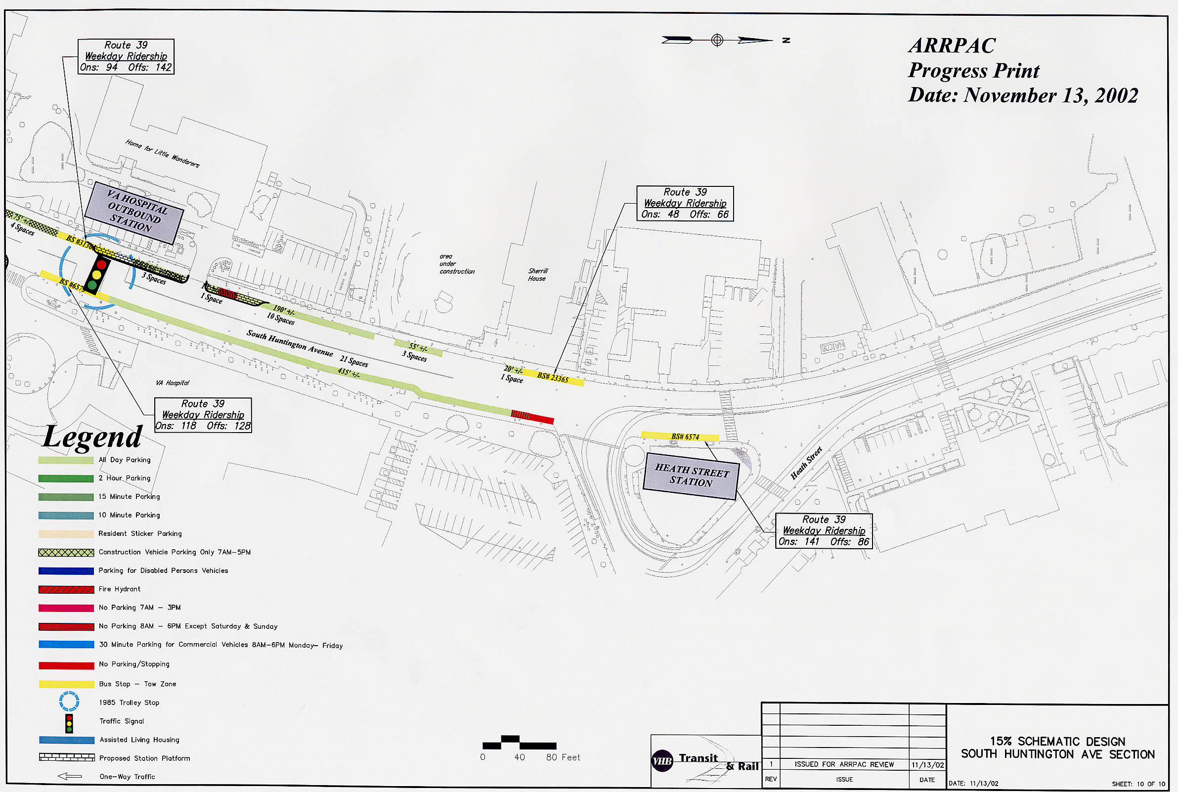
Existing Conditions
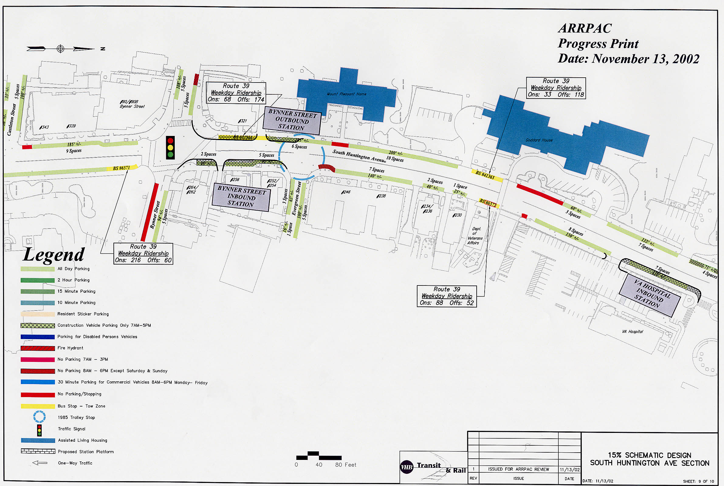
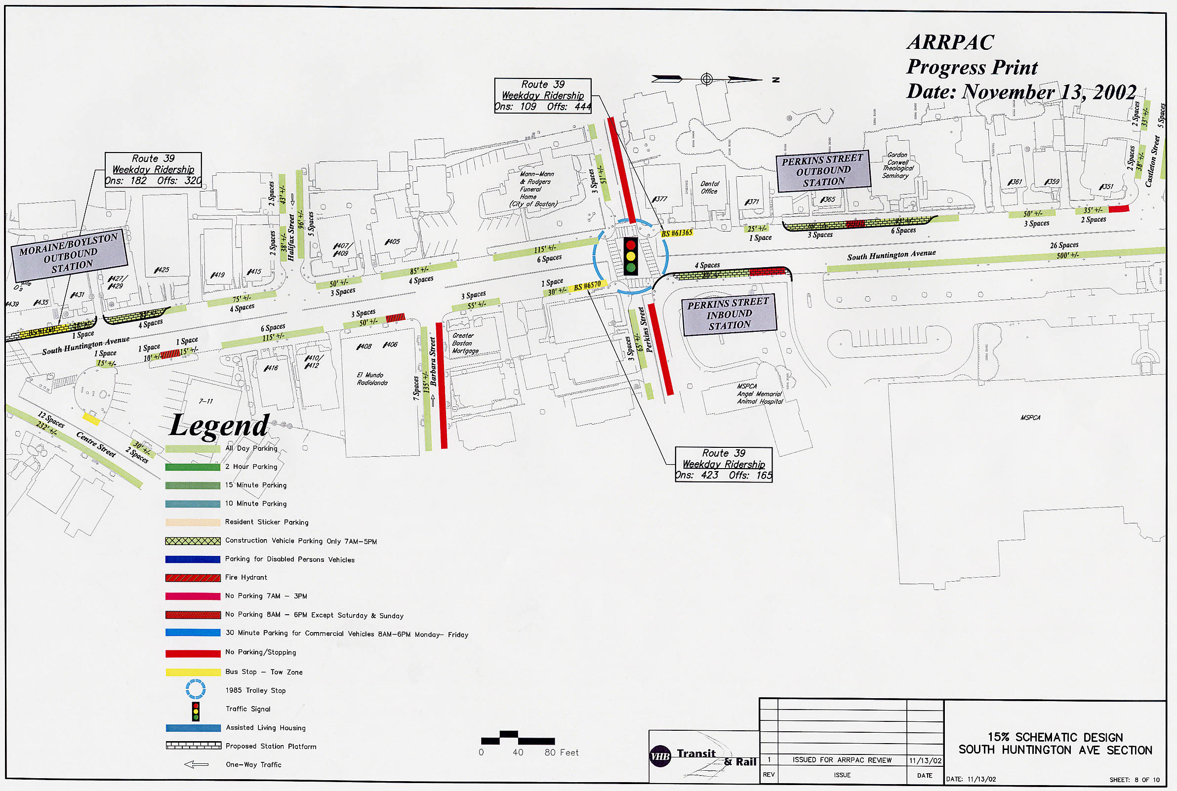
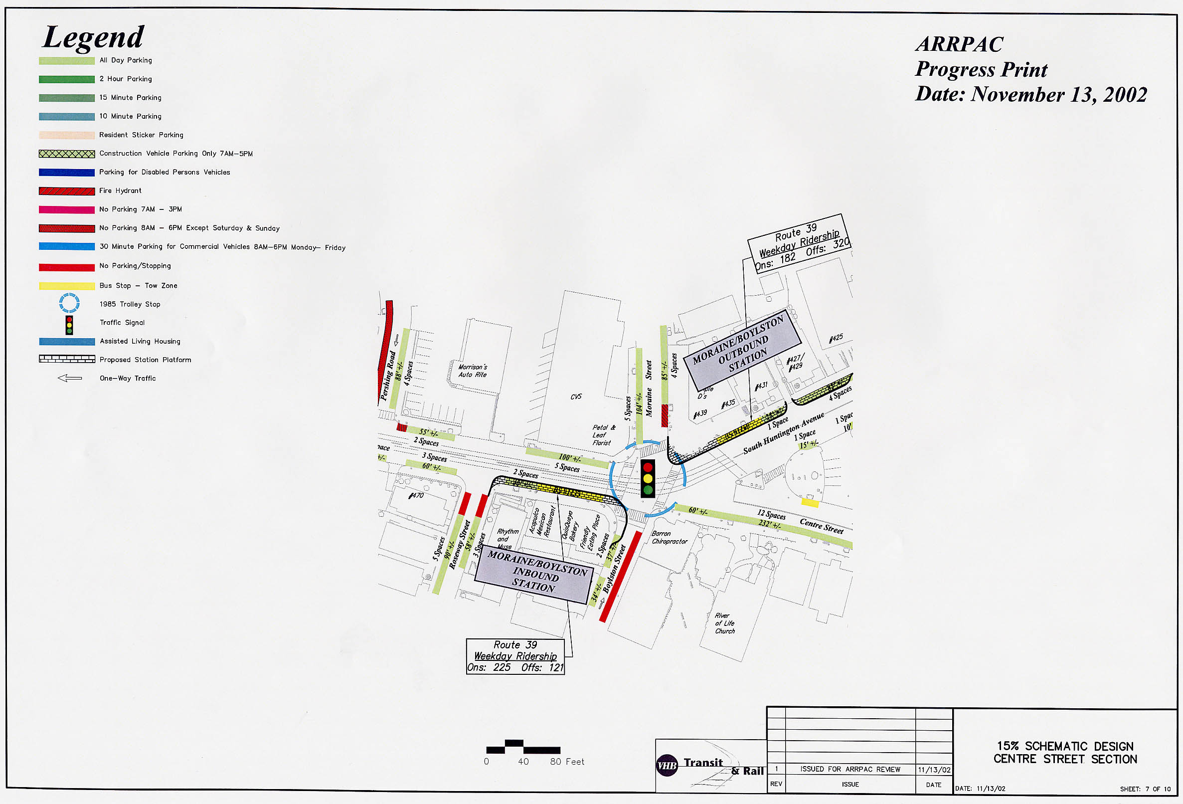
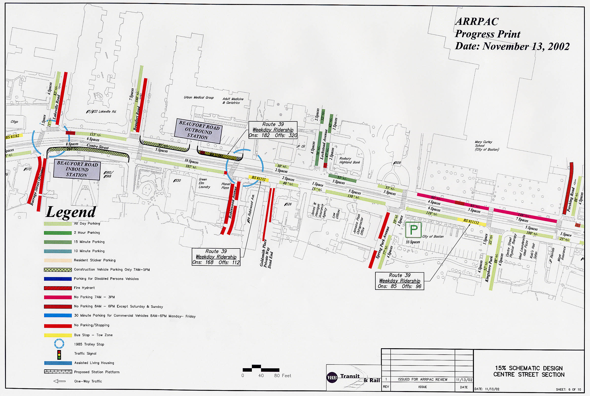
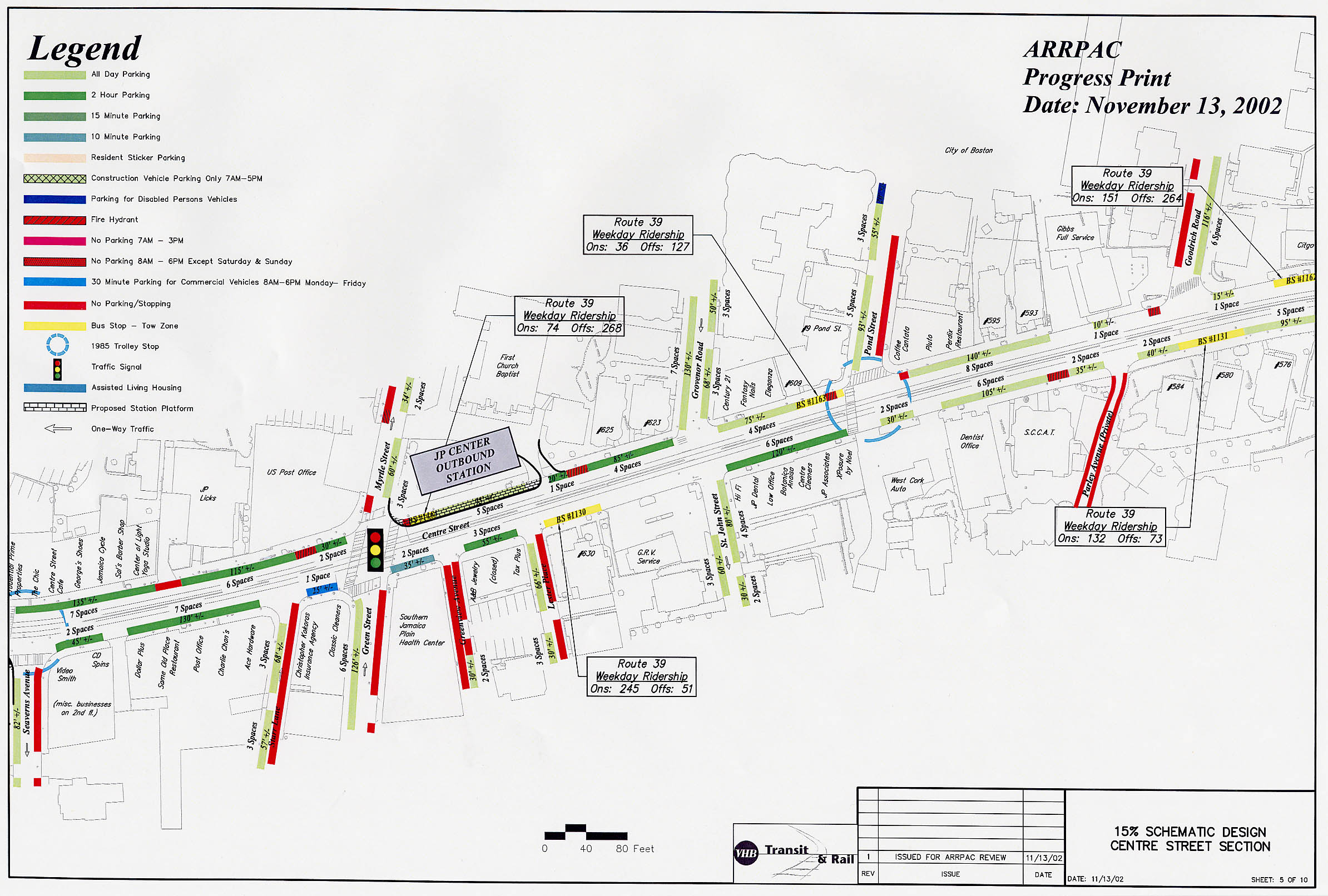
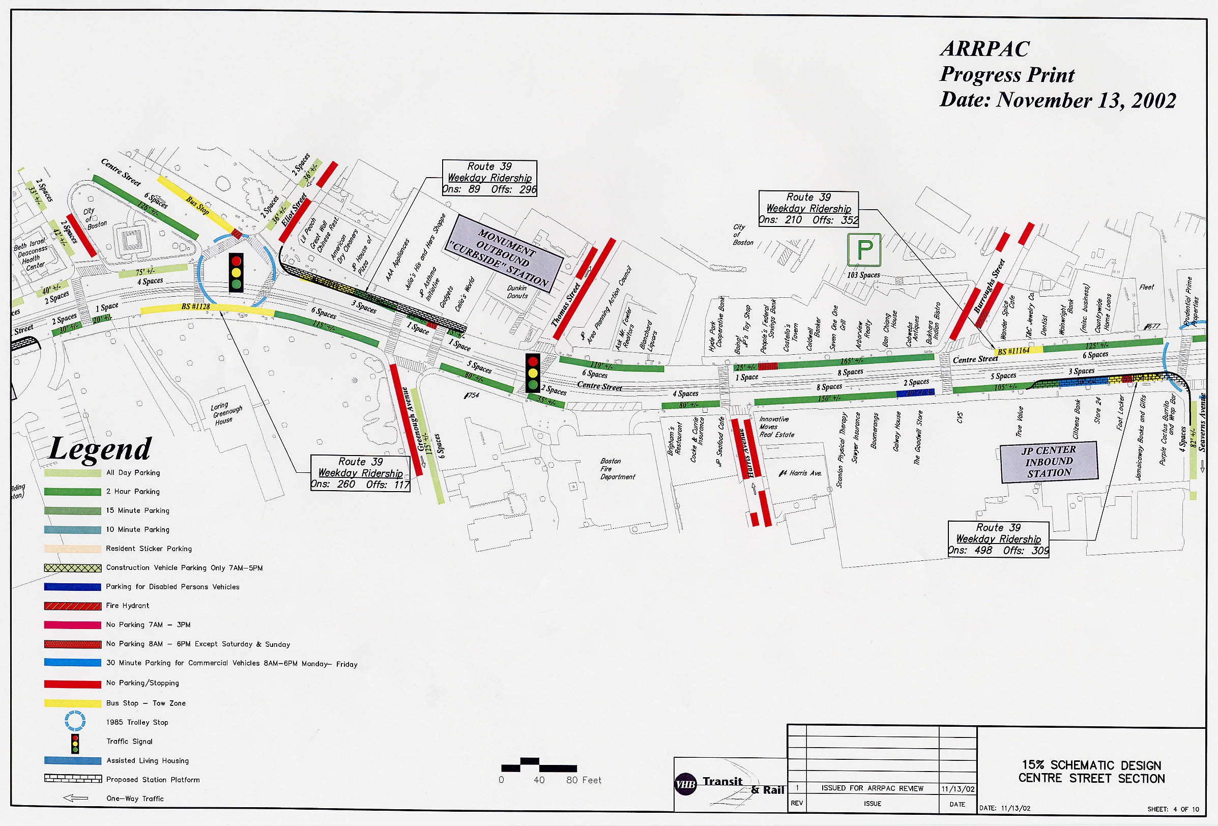
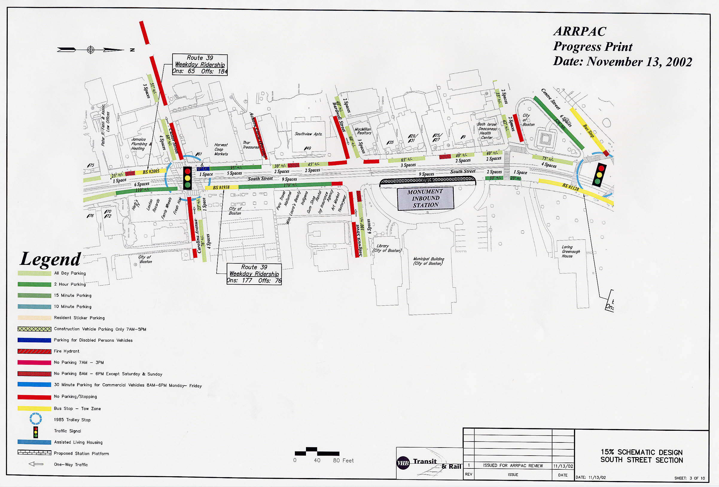
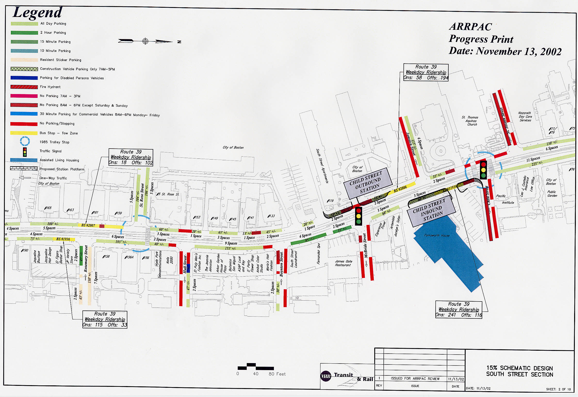
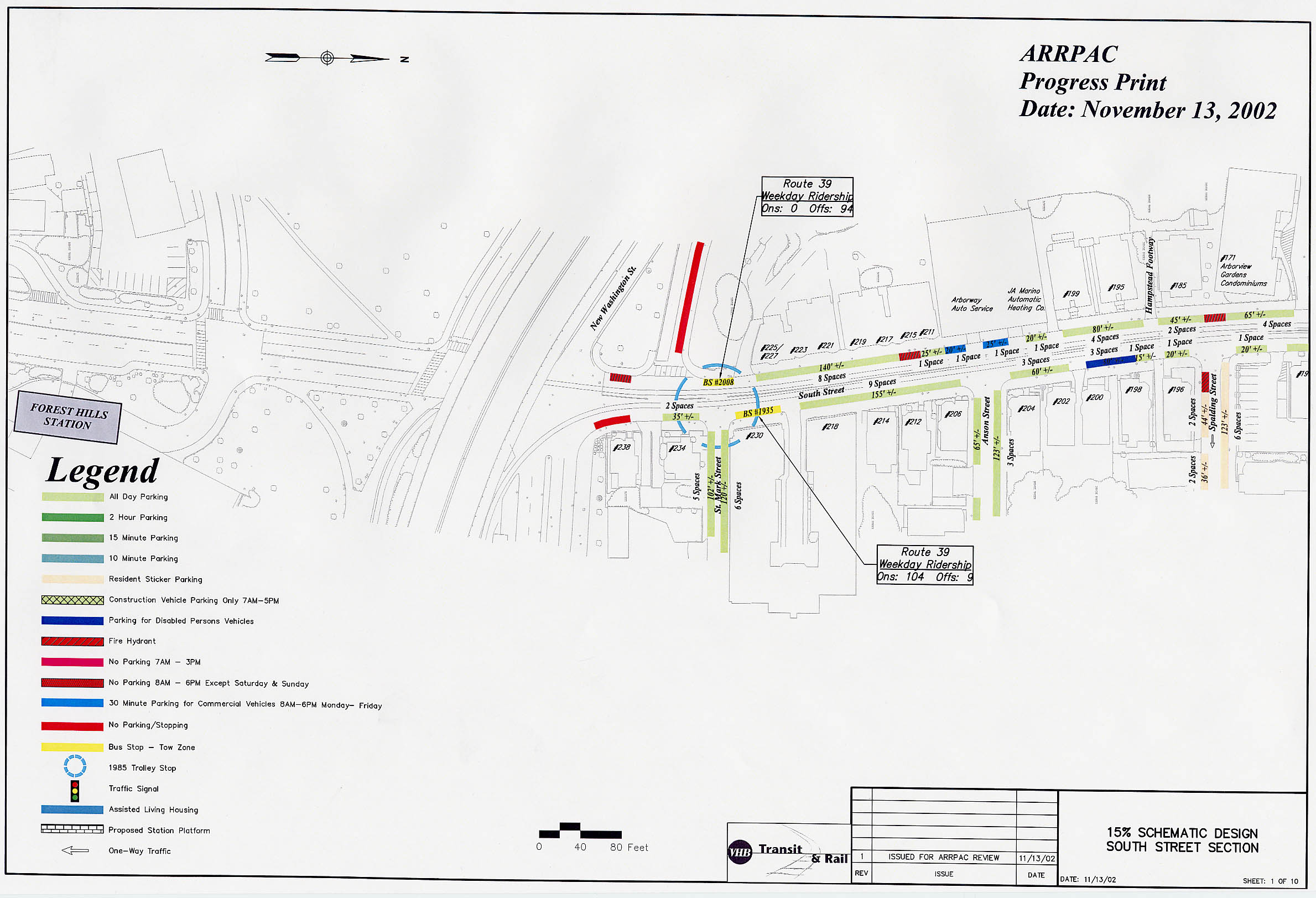
The MBTA has provided a set of detailed charts showing existing conditions along the Arborway corridor. These illustrations show the exact configuration of the streets, including intersections, crosswalks, parking spaces, bus stops, fire hydrants, etc. Possible site locations for the proposed stations are also indicated. These are available as a series of 10 high-resolution images, each covering a portion of the corridor:
|
||||||||||||||||||||||||||||||||||||||||||||||||||||||||||||||||||||||||||||||||||||||